New Mexico Burn Scar - Hazard Tree Identification
Client
New Mexico Department of Homeland Security & Emergency Management
Location
New Mexico
Category
Survey & Mapping
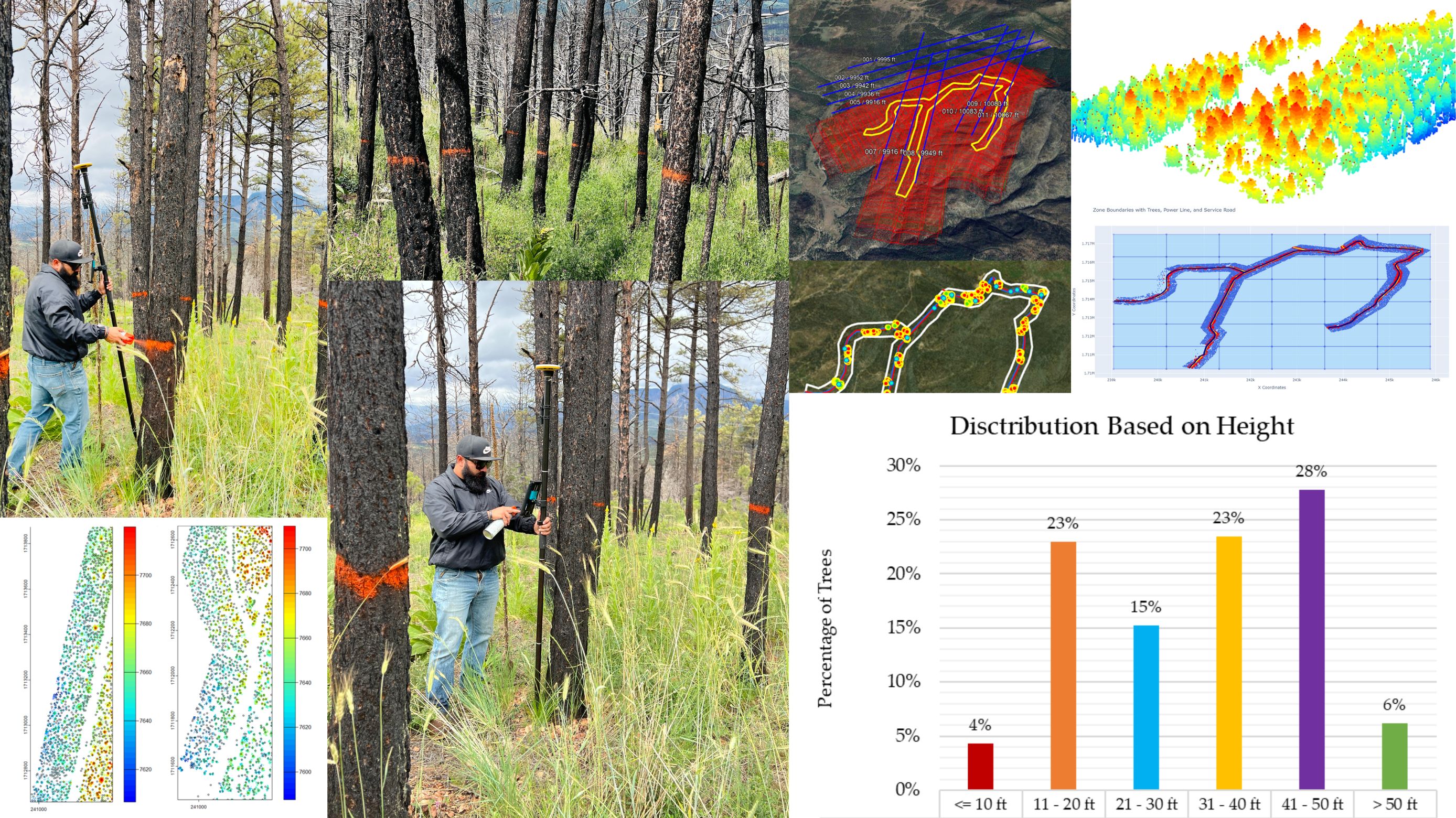
Identifying Burned Trees Along the Mora–San Miguel Coop Powerline Right‑of‑Way
Following wildfire activity, burned and dead trees within the powerline corridor posed immediate hazards to conductors, access roads, and crew safety. NMDHSEM contracted FORCE to map, assess, and prioritize burned-tree removals along the Mora–San Miguel Cooperative powerline.
Approach
- Collected airborne LiDAR and processed point clouds (classification: ground, high vegetation, noise).
- Zoned the corridor for efficient processing; applied tree-detection and segmentation algorithms to count and locate treetops.
- Field-validated results using stratified checks and sub‑meter GNSS; recorded char/decay class, DBH, height, lean, snag stability, and likely drop direction.
- Scored each tree using an adapted burn‑hazard rubric to assign treatment urgency.
Deliverables
- Geodatabase of inspected trees with photos and full attributes
- GIS layers of prioritized removals/prunes (urgent / near‑term / monitor)
- Maps showing treatment zones, safety buffers, and access routes
- Orthomosaic & LiDAR products plus a technical report and QA/QC summary
Outcome
Provided NMDHSEM and Mora–San Miguel Coop a validated, GIS-ready mitigation plan that reduced outage risk and improved crew safety while enabling targeted field remediation.